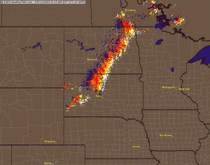
The image on the right is an animated image of lightning strikes on 09/11/09. It shows a line of thunderstorms heading towards Grand Forks County and the city of Grand Forks. Notice as the line approaches Grand Forks, the lightning frequency is almost nonexistent. Once the line moves east of Grand Forks, the lightning frequency suddenly increases again.
Oh Mother Nature, your Grand Forks Thunder Buffer never fails.
UPDATE…….MORE EVIDENCE
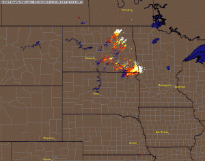
This image is from the same year, on July 14th 09. Notice, again, that the lightning track does the banana splits around the greater Grand Forks area.


[...] can also see the weather hole at work in the summer in this post Share Posted in weather | Tags: Grand Forks, meteorology, snow, snowfall, weather, Weather Hole [...]